|
|
||||
|
Home � 2003
Lakeweb1
Visit the ItascaWeb Shopping Guide
|
|||||||||||||||
|
WANTED! Do you have photos, historical accounts or other items pertaining to the Inger area? Would you like to share this historical information with the world? ItascaWeb would like to publish your Inger photos (current or historical) or historical accounts on this website. Original materials can be returned and your privacy will be respected. |

Home
|
Attractions
| Businesses
| Campgrounds
| Cities
& Towns | Government
History | Events
| Links
|
Motels |
Resorts
A-L | Resorts
M-Z |
Travel
Inger Township was named for one of its pioneer settlers. A post office was operated in section 17, 1912-54, becoming a rural branch, 1954-55.
In the 1600's, the Dakota Indians had communities at Leech lake. The Ojibwe bands moved into the region during the mid-to-late 1700's. The first Ojibwe settlements were on small islands on Leech Lake. This area in north central Minnesota was the home of the Mississippi and Pillager Ojibwe bands. In 1847, treaties took sections on the southwest corner of their lands with the Mississippi and Pillager bands from the Menominee and Winnebago tribes that were to be moved from Wisconsin. The remaining land was ceded by treaty in 1855 that established the reservation. The 1864 Treaty expanded and consolidated the reservation in the area of the three lakes. The intent at that time was to have the other Minnesota Ojibwe bands move to the Leech Lake area. By 1867, the plan was changed and White Earth Reservation was created to be the home of all Ojibwe people. The area of the Leech Lake Reservation was reduced by executive orders however, in 1873 and 1874 added land.
Located along US Highway 2, the reservation is southeast of Bemidji with Walker just outside on the southwest corner. Cass Lake is the largest community within the reservation. Eleven communities make up the reservation. In addition to Cass Lake, there are Ball Club, Bena, Inger, Onigum, Mission, Pennington, Smokey Point, Sugar Point, Oak Point, and Squaw Lake. Oak Point had previously been known as Squaw Point but was renamed in 1995. The reservation is split among four counties, Cass, Itasca, Beltrami, and Hubbard and is divided among seven Minnesota school districts.
Drained by the headwaters of the Mississippi River, the area is generally swampy. With some 40 wild rice producing lakes, it has the largest natural wild rice production of any of the State's reservations. The land is mostly second growth. The Leech Lake Tribe holds the smallest percentage of its reservation of any of the state's tribes. County, state, and federal governments owned well over half of the original land. Of the 677,099 original acres, 212,000 acres are surface area of the three big lakes. Of the remaining 465,000 acres, other levels of government own 332,804 acres. The National Chippewa Forest has the largest portion of the land. Seventy-five percent of the National Forest is within the reservation.
The Leech Lake Tribal Council is the governing body with their offices in Cass Lake and is a member of the MCT. In the early 1990's, the Tribe contracted with the BIA to operate programs under self-governance procedures as one of the second groups of ten tribes allowed into the pilot project. The State is responsible for criminal and some civil jurisdiction over Indians on the reservation. The Leech Lake Tribe issues its own automobile license plates.
| Leech Lake Band of Ojibwe Inger Local Council | ||
| Chairperson | Donna Cloud | |
| Vice-Chairman | Melissa Bowstring | |
| Secretary/Treasurer | Dorothy Robinson | |
|
|
||

| DeBahJiMon Newspaper | 6530 Highway 2 NW Cass Lake, MN 56633 |
(218) 335-8225 |
Leech Lake Band of Ojibwe Web Site -

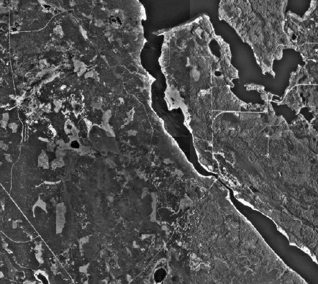
Aerial photo is courtesy of
Microsoft's Terra
Server
and the
US Geological Survey

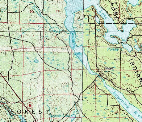
Topographic photo is courtesy of
Microsoft's Terra
Server and the
US Geological Survey
You are viewing the ItascaWeb.com
Inger page.
|
||||||||||||
|
|
� 2004
Lakeweb1 Internet Services All Rights Reserved Changes/additions/deletions/comments: [email protected] |
|
||||||||||
|
|
||||||||||||