|
Home
Attractions
Businesses
Campgrounds
Cities & Towns
Government
History
Events
Links
Motels
Resorts A-L
Resorts M-Z
Travel
� 2003
Lakeweb1
Internet Services
All Rights Reserved







|
Itasca County Area Campgrounds
Private
|
National Forest
|
State | Municipal & County
Private Campgrounds
Backwoods
Resort & RV Park
36745 County Road 238
(218) 246-2542
Deer River, MN 5663614 full
hookup RV sites. Shower house, game room, beach, boat
launch, playground, dock space, & bait. Moose Lake is
known for muskie, walleye, northern pike, bass, perch,
& bluegill fishing. Sites are lake level with open &
wooded sites available. Daily, weekly & seasonal rates
available.
Lake: Moose
Lake Size: 1265 acres
Depth Map
Fishing Data
Topographic Map
Recreational Map
Mappoint Map
MapQuest Map
|
|
Birch Cove Campground
32382 Southwood Road
Grand Rapids, MN 55744
Phone: (218) 326-8754On beautiful
16,000 acre Pokegama Lake. 14 birch shaded RV/camp sites.
Water, electric and sewer Hookups. Modern restroom and
shower facilities, picnic tables, fire rings, firewood,
boat launch, docks. Boat, motor, pontoon, canoe and
paddleboat rentals.
Lake: Pokegama
Lake Size: 16612 acres
Depth Map
Fishing Data
Topographic Map
Recreational Map
Mappoint Map
Mapquest Map
|
|
Bojou Lodge
& Resort
PO Box 397
Squaw Lake, MN 56681
Phone: (218) 659-4203
E-Mail: [email protected]
Bojou Lodge Resort & Campground is open
from beginning of fishing season in mid May through
the end of deer hunting season in mid November. We have
seven completely modern cabins and four full hook up
campsites and a shower house available for your stay
with us.
Lake: Round
Lake Size: 2828 acres
Depth Map
Fishing Data
Topographic Map
Recreational Map
|
|

|
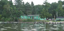
Bowen Lodge & Campground
58485 Bowens Road
Deer River, MN 56636
Phone: (218) 246-8707
Toll free: (800) 331-8925Our
tent sites include fire ring, picnic table and full
use of our resort facilities. We offer two secluded
camping areas:
Minnow Lake: Five secluded and very
private sites. Excellent for spring and fall camping.
No facilities. Primitive tenting only.
Trailer Park: Five designated areas
in our RV Park close to the showers and restrooms.
Lake: Winnibigoshish
Lake Size: 58,544 acres
Depth Map
Fishing Data
Topographic Map
Recreational Map
|
|


|
Cottonwood Lake Campground
Box 157
Deer River, MN 55636
Phone: (218) 246-8343 |
|
Fishing Springs Campground
18862 Sherrys Arm Rd
Grand Rapids, MN 55744
Phone: (218) 326-5648 |
|
Ghost Bay Campground
52382 S Center Road
Spring Lake, MN 56680
Phone: (218) 659-2128 |
|
Hay Lake Campground
PO Box 9
Hill City, MN 55748
Phone: (218) 697-2476 |
|
Hidden Haven Campground
31516 Malbay Road
Cohasset, MN 55721
Phone: (218) 246-8989 |
|
Jessie View RV Campground
45756 County Road 35
Deer River, MN 55636
Phone: (218) 832-3678
Email: [email protected]
RV Park and campground facilities are
open May 1 - Mid October. We feature 22 new full hook-up
RV sites - some with 50 Amp electric. There are also
15 "primitive" sites with electric only. Our 40 acres
provide plenty of space for tent camping. We have seasonal
sites available. Contact us for specific information.
Lake: Jessie Lake
Lake Size: 1753 acres
Depth Map
Fishing Data
Topographic Map
Recreational Map
MapQuest Map
|
|


|
Larson Lake Campground
PO Box 95
Effie, MN 56639
Phone: (218) 743-3694 |
|
|
|

|
New Leech Lake Campground
12962 Sunset Beach Rd NW
Bena, MN
Phone: (218) 654-3785 |
|
Northern Acres Resort & Campground
47292 Bowstring Access
Deer River MN 56636
Phone: (218) 659-2845
(evenings & weekends)
Phone: (218) 659-2885
(days & fax)Lake: Bowstring
|
|

|
|
|

|
|
|

|
Quadna Mountain
Campground and RV Park
100 Quadna Road
Hill City, MN
Full and partial hook-ups, wilderness tent sites, showers
and laundry. Paved hiking and biking trails.
Phone: Toll Free (800) 442-6649 |
|
|

|
|
|

|
Snug Harbor Resort
50351 Co Rd 35
Deer River MN 56636
Phone: 218-832-3466
Toll Free 1-800-419-5289
Lake: Bowstring |
|

|
|
|

|
Swan Lake Campground
Star Route 1, Box 133
Pengilly, MN
Phone: (218) 885-3385
Lake: Swan |
|
|
|

|
Public Campgrounds
Chippewa National Forest
| Clubhouse Campground, on the
west shore of Clubhouse Lake, offers 47 sites, a sandy swimming
beach, accessible fishing pier and day use area. Clubhouse
Lake is 90 feet deep, perfect fishing for northern pike, bass and
panfish. For those with a smaller boat or canoe, water access
to several lakes is possible. The Rice River canoe route starts
its journey to the Bigfork River from waters that flow into Clubhouse
Lake. Reservations can be made at the Clubhouse campground.
Clubhouse Site Map
|
| The Cut Foot Horse Camp
is surrounded by over 120 miles of Forest Roads and recreation trails.
Drive 3.2 miles past the Cut Foot Sioux Visitor Center along Highway
46, turn left on Forest Road 2171 and go three miles . A picket
line is provided for tying your horse and there are manure pits
located at the campsites.
Cut Foot Camp Site Map
|
| Deer Lake Campground
is located 20 miles northwest of Deer River off Highway
46, four miles west on Eagle Nest Road (Forest Road 2198).
The campground, located on the west shore of Cut Foot Sioux Lake,
is split into two separate loops. North Deer Lake Campground
has 17 sites, while South Deer Lake has 31 campsites.
A boat ramp is centrally located between the loops and provides
lake access via Biauswah Creek. The 26-mile Cut Foot Sioux
National Recreation trail runs through the Deer Lake campgrounds
and is designated for horseback rising and mountain biking.
A designated swimming beach is located at North Deer campground.
Deer Lake Campground is on the reservation system.
Deer Lake Site Map
|
|
East Seelye Bay Campground
is located 20 miles north of Deer River on Highway 46.
Turn west on Eagle Nest Road (Forest Road 2198) and follow the road
for 2 1/2 miles. East Seelye Bay has 13 campsites, a picnic
area, swimming beach, boat ramp and parking area. The Cut
Foot Sioux National Recreation Trail runs past the campground and
up along Seelye Point.
East Seelye Bay Site Map
|
| Mosomo Point Campground is located
19 miles north of Deer River on Highway 46. Turn west on Forest
Road 2190, just half mile past the Cut Foot Sioux Information Center.
Mosomo Point reaches out into the transition area between Little
Cut Foot Sioux and Big Cut Foot Sioux Lakes, and provides a protected
spot off the big lake for fishing boats. There are 23 sites
along Mosomo Point.
Mosomo Site Map
|
 |
| Noma Lake Campground is located
two miles northwest of Wirt, Minnesota on County Road 31. This campground
has 14 sites surrounded by a beautiful stand of paper birch.
Noma Lake offers good fishing for bass, northern pike, and panfish.
A boat ramp is located at the south end of Noma Lake. A fish
cleaning station and firewood are also available.
Noma Lake Site Map
|
 |
| North Star Campground is located
four miles from Marcell or 25 miles from Grand Rapids. Thirty-eight
campsites are located within easy walking distance of the sandy
swimming beach. The lake has many sheltered bays and inlets
to provide quiet water for ideal fishing.
North Star Site Map
|
| O-Ne-Gum-E Campground
is located 18 miles northwest of Deer River on Highway
46, centered in the Chippewa National Forest's premier fishing
area. With access to Little Cut Foot Sioux, Cut
Foot Sioux, and Winnibigoshish Lakes, O-Ne-Gum-E attracts a large
number of visitors each summer. There are 48 campsites available
with 11 sites located along the Little Cut Foot Sioux. O-Ne-Gum-E
sites are on the reservation system.
O-Ne-Gum-E Site Map
|
|
Tamarack Point Campground
is located 13 miles north of Deer River on Highway 46.
Turn west off 46 onto County Road 9. Travel six miles south
along County 9 before turning west onto Forest Road 2163.
The campground is approximately five miles northwest on Forest Road
2163. There are 32 sites available at the campground, with
boat access and docking provided.
Tamarack Site Map
|
| Webster Lake Campground
is located seven miles south of Blackduck, Minnesota on
County Road 39. Follow Forest Road 2207 east for one mile,
then drive two miles south on Forest Road 2236. The campground
provides access to Webster Lake, a picnic area and a large trail
system.
Webster Lake Site Map
|
| West Seelye Bay Campground
is located 20 miles north of Deer River on Highway 46,
and three miles west on Eagle Nest Road (Forest Road 2198).
This campground provides 22 campsites and access to the boat ramp
near the East Seelye Bay picnic area. The campground is located
on Cut Foot Sioux Lake which is well know for its excellent walleye
and northern pike fishing.
West Seelye Bay Site Map
|
| Williams Narrow Campground
is located 15 miles north of Deer River on Highway 46,
then miles west on William Narrows-Bowens Road (County Road 148).
This campground, on Cut Foot Sioux Lake, has 17 campsites as well
as a boat landing and swimming beach located between the upper and
lower loops. Hikers can access the Simpson Creek trailhead
by boating across the narrows, while bird watchers have an excellent
chance of seeing bald eagles soaring overhead.
Williams Narrow Site Map
|
| Winnie Campground
is located 18 miles form Cass Lake, Minnesota. Take Highway
2 six miles east. Turn north on County Road 10 and drive two
miles to Forest Road 2171. Drive six miles northeast on Forest
Road 2171 to Forest Road 2168, then four miles south to the campground.
Winnie provides 35 campsites surrounded by red and white pine and
a boat ramp.
View the
Winnie Campground
|
|
Campgrounds
Minnesota State Park & Forest
|
Bowstring State Forest - Cottonwood Lake Campground
10 drive-in sites, vault toilet, well, walking
paths, swimming and fishing.
Good panfish lake, great for kids.
Contact Information:
P.O. Box 157, Deer River MN 56636
Phone: 218-246-8343
Directions:
From Deer River take St. Hwy. 6 North 4 miles
to County Road 19; turn right (East) 3 miles; turn left (North)
on County Road 48, 1.5 mi.; turn right (East) on County Road 160
and follow signs about 2.5 mile.
|
George Washington State Forest
Bear Lake Campground and DUA
27 drive-in sites, 2 accessible
sites. Located on a nice lake with good walleye and crappie
fishing. Picnic sites with shelters.
Contact Information:
1208 E Howard St Hibbing MN 55746
Phone: 218-262-6760
Directions:
From Nashwauk take St. Hwy. 65 N. 23 mi. to Co.Rd. 52 (Venning
Rd.); turn left (W) 2 mi.; turn left (S) 2.5 mi.
Button Box Lake Campground and DUA
10 drive-in sites and 2 walk-in
sites. Vault toilet, water well, walking paths. Picnic sites.
On a nice bass and panfish lake.
Contact Information:
1208 E Howard St Hibbing MN 55746
Phone: 218-262-6760
Directions:
From Togo take St. Hwy. 1 W. 4.5 mi.; turn right (NW) 4 mi.
Larson Lake Campground
12 drive-in camping sites plus
1 accessible site located on a designated trout lake.
Contact Information:
P.O. Box 95, Effie, MN 56639
Phone: 218-743-3694
Directions:
From Effie take St. Hwy. 1 E. 11 mi. to Bass Lake Rd.; turn
right (S) about 2 mi. to junction; turn right (W) 1 mi.
Lost Lake Campground
15 drive-in camping sites, 1
accessible site, well, good panfish fishing.
Contact Information:
P.O. Box 95, Effie MN 56639
Phone: (218) 743-3694
Directions:
From Bigfork take Scenic Hwy. (Co.Rd. 7) S.E. 10 mi. to Co.Rd.
340; turn left (E) about 7 mi. to Co.Rd. 52; turn left (N.E.)
and follow signs 2 mi.
Owen Lake Campground and DUA
19 drive-in camping sites and
1 walk-in site. Vault toilets, well, walking paths. Picnic sites,
swimming, panfish and northern in lake.
Contact Information:
Box 95, Effie MN 56639
Phone: (218) 743-3694
Directions:
From Bigfork take Scenic Hwy. (Co.Rd. 7) S.E. 10 mi. to Co.Rd.
340; turn left (E) about 7 mi. to Co.Rd. 52; tukrn left (N.E.)
and follow signs 2 mi.
Thistledew Lake Campground and DUA
21 drive-in camping sites, vault
toilets, well, walking paths. Swimming, dock, and fishing.
Walleye and crappies plentiful.
Contact Information:
1208 E Howard St Hibbing 55746
Phone: 218-262-6760
Directions:
From Togo take Hwy 1 W. 4.5 mi.; turn left (S) .5 mi.; turn
left (E) 1.25 mi.
Togo Horse Campground
13 horse camping sites, well,
vault toilets.
Contact Information:
1208 E. Howard St., Hibbing MN 55726
Phone: 218-262-6760
Directions:
From Togo take Hwy 1 (W) 4.5 mi.; turn left (S) .5 mi.; turn
left (E) .5 mi.
|
|
Scenic State Park
Sites are located in two campground...Chase Point
and Lodge campgrounds. Chase Point campground is on a hill above
the lake. Lake can be accessed by steps that lead to a boardwalk.
Non-electric sites in this campground have a reasonable amount of
screening between sites. The electric sites are more open. The Lodge
campground sites are predominantly open with moderate amounts of
screening at some sites. Chase Point campground is closest to park
office. Lodge campground is closer to the beach and fishing pier.
About 20 campsites are kept open for winter camping in the Chase
Point campground. These are electric sites.
Park Map [PDF format]
|
|
Schoolcraft State Park
This secluded north woods park is the perfect
place to unwind. Quiet and peaceful, the trail system leads hikers
through the virgin pine forest that includes a white pine more than
300 years old. Canoeists and anglers enjoy the gentle waters of
the Mississippi River. A boat access, picnic area, canoe and drive-in
campsites are available to visitors.
Park Map [PDF format]
|
Campgrounds
Municipal and County
Bass Lake Park/Campground
County Park System
Land Department
State Highway 1
11 miles east of Effie and 11 miles west of Togo
Phone: (218) 327-2885 |
Kom-On-In Beach and Public Recreational
Area
Box 696
Coleraine, MN
Phone: (218) 245-3382 |
Hill City Park Campground
PO Box 160
Hill City, MN 55748
Phone: (218) 697-2301 |
Itasca County Fairgrounds
1336 Third Ave. NE
Grand Rapids, MN 55744
Phone: (218) 326-6470 |
|
|
|








 |
